3D MODELLING & VISUALISATION
The future.Already visible.
From a first design to a complete area development. We bring plans to life with interactive 3D environments, photorealistic visualisations and striking animations.
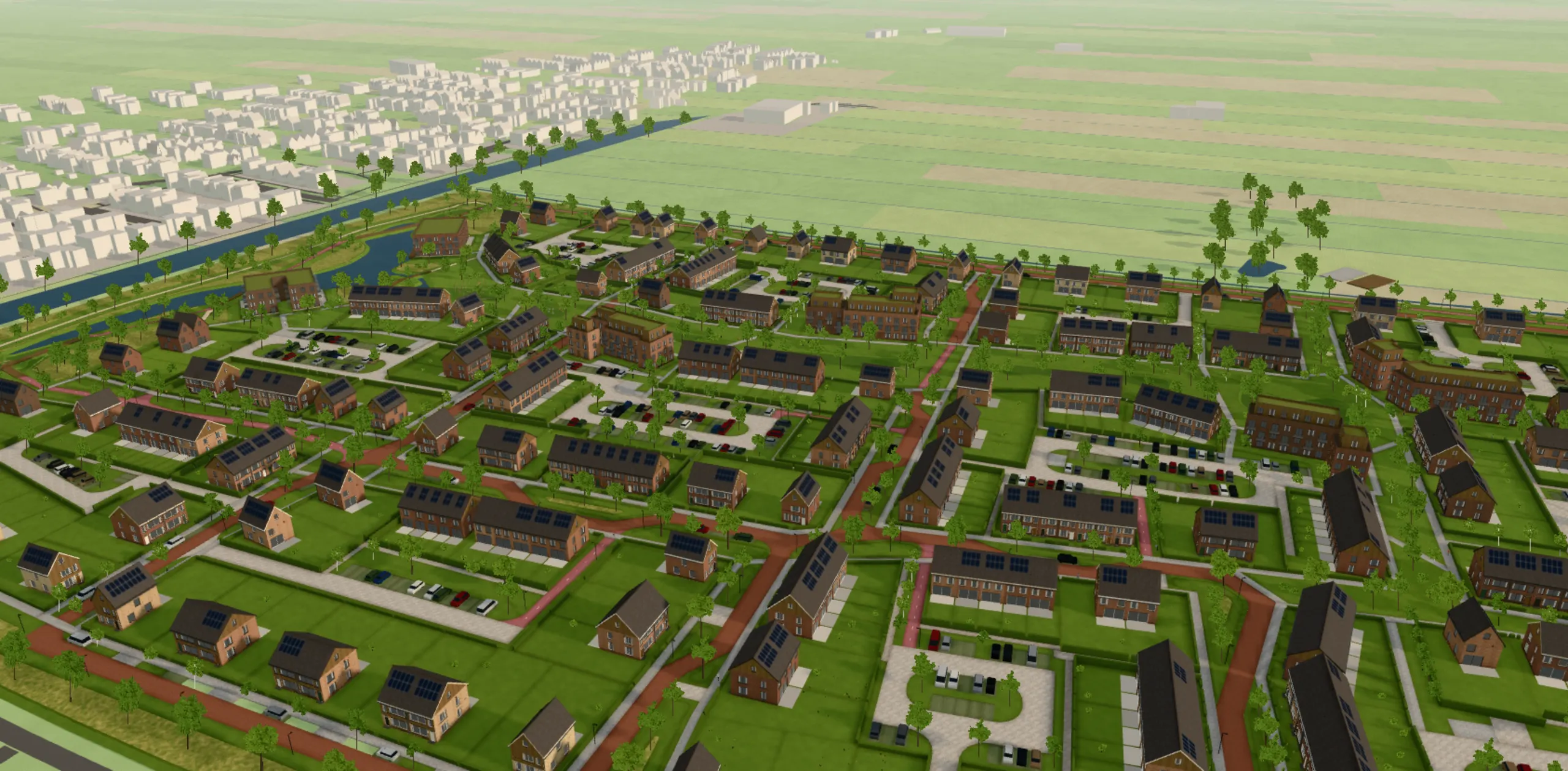
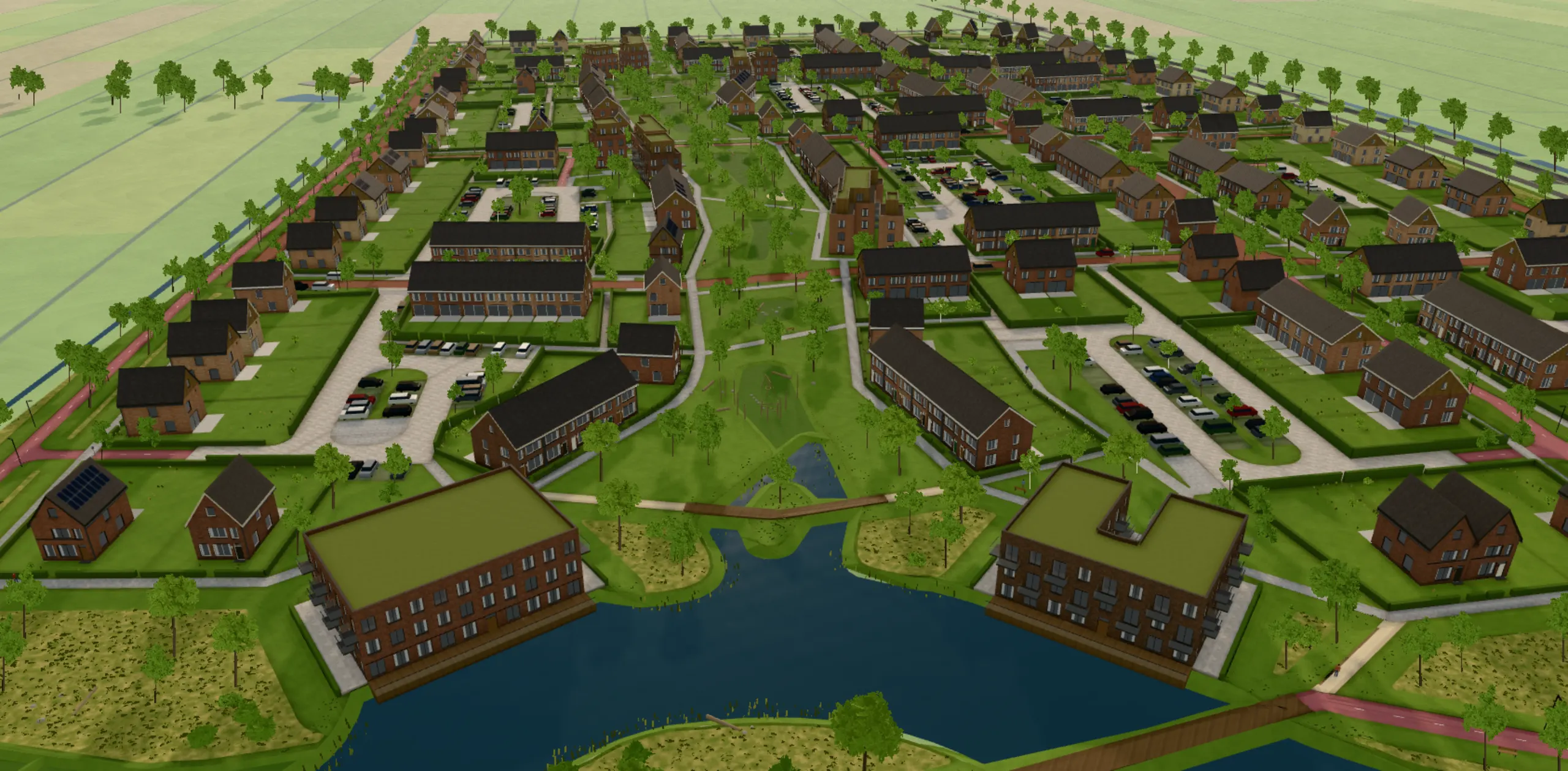
Vjenne Zuid in 3D · Gemeente Twenterand
Impression. Surroundings: 3D Basisvoorziening, © Kadaster, CC BY 4.0.
FROM PLAN TO EXPERIENCE
Why explain something when you can show it?
A building drawing tells you what is coming. A 3D visualisation lets you experience what it will be like. We turn designs, spatial plans and property concepts into compelling visual experiences. That way you make ideas tangible, build enthusiasm and give buyers, investors and stakeholders a clear picture of what is going to be created.
3D isn’t just a pretty picture. It’s a way to sell plans, explain them and win support.
WHAT WE MAKE
Five ways to show the future.
Interactive 3D environments
Let people navigate virtually through future building projects, neighbourhoods and areas. Ideal for project presentations, public participation and sales.
- Illustration
Photorealistic 3D renders
Present buildings, homes and architectural designs with images that convincingly show atmosphere, materials, light and detail.
3D animations & flythroughs
Set future environments in motion with cinematic camera moves, walkthroughs and animations.
Complete area visualisations
Make large-scale spatial developments easy to grasp. Visualise future residential areas, public spaces and area developments as a whole.
- Illustration
Interactive project configurators
Let users explore projects and, depending on what the project allows, make choices about homes, layouts, finishes or other available options.
FEATURED PROJECT
Vjenne Zuid. A future you can explore today.
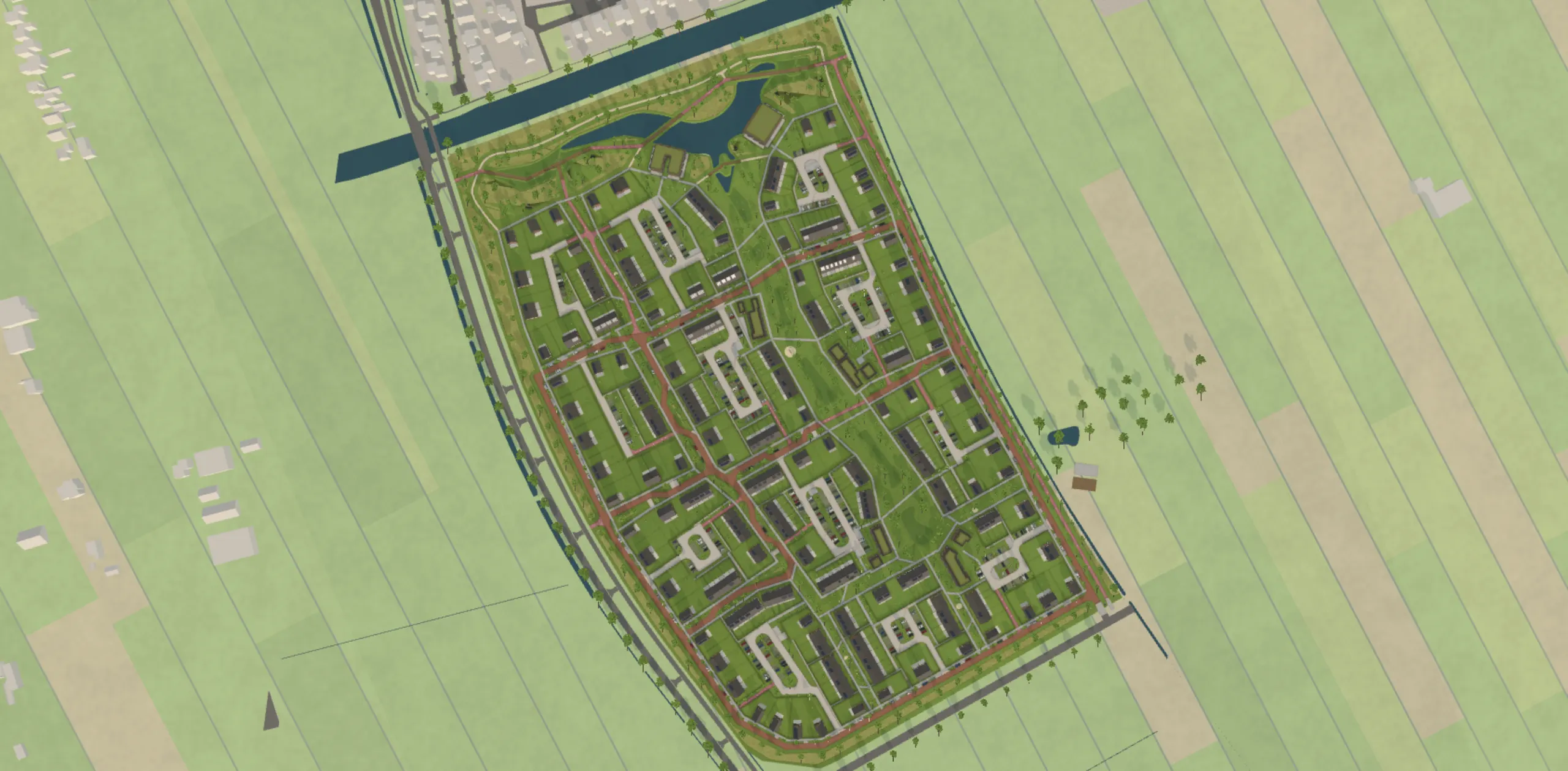
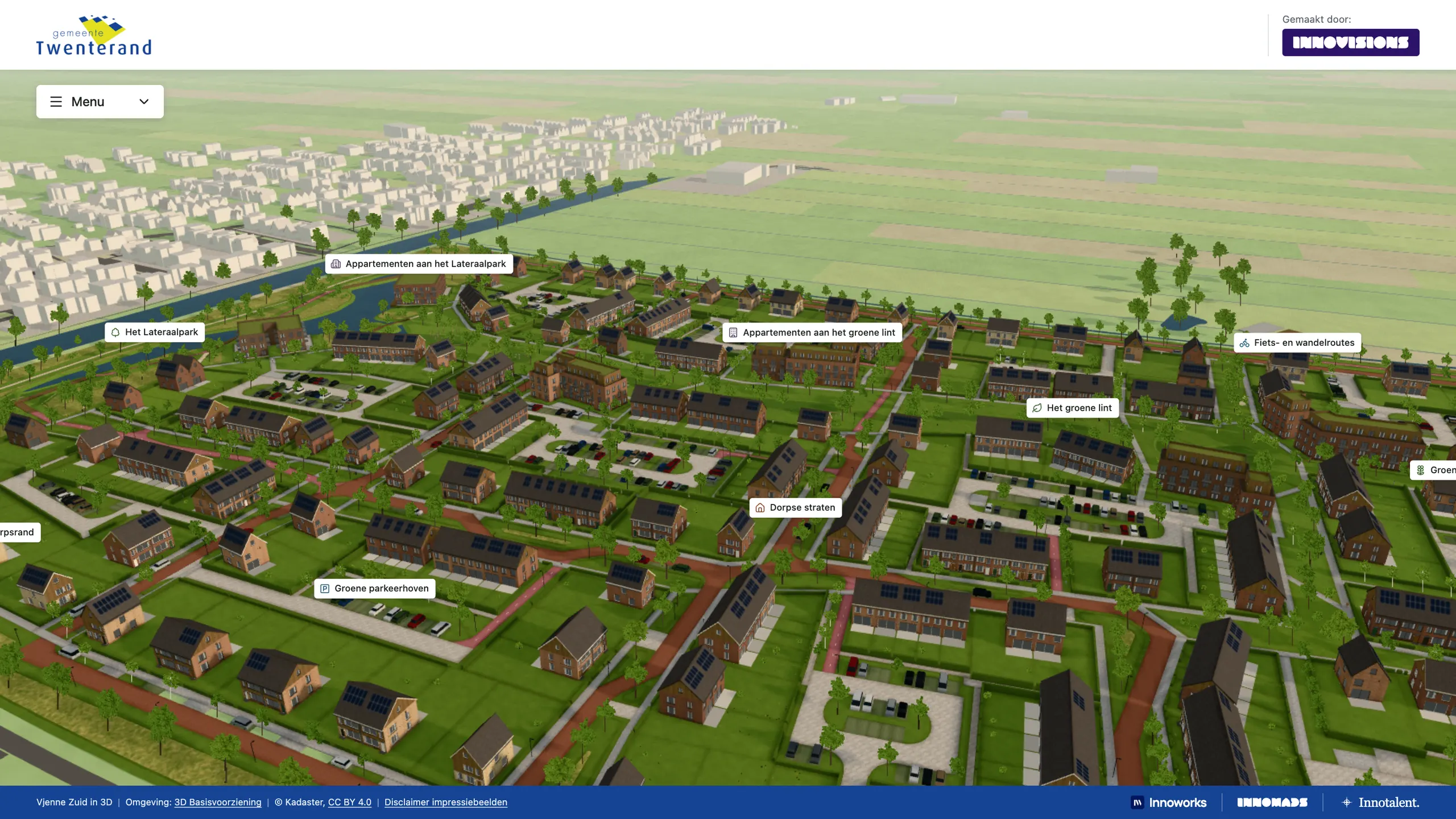
How do you bring a future area to life before it has been built? For the municipality of Twenterand we developed Vjenne Zuid in 3D: an interactive environment in which visitors can explore the project digitally and get a picture of the future development.
 ClientGemeente Twenterand
What visitors can do
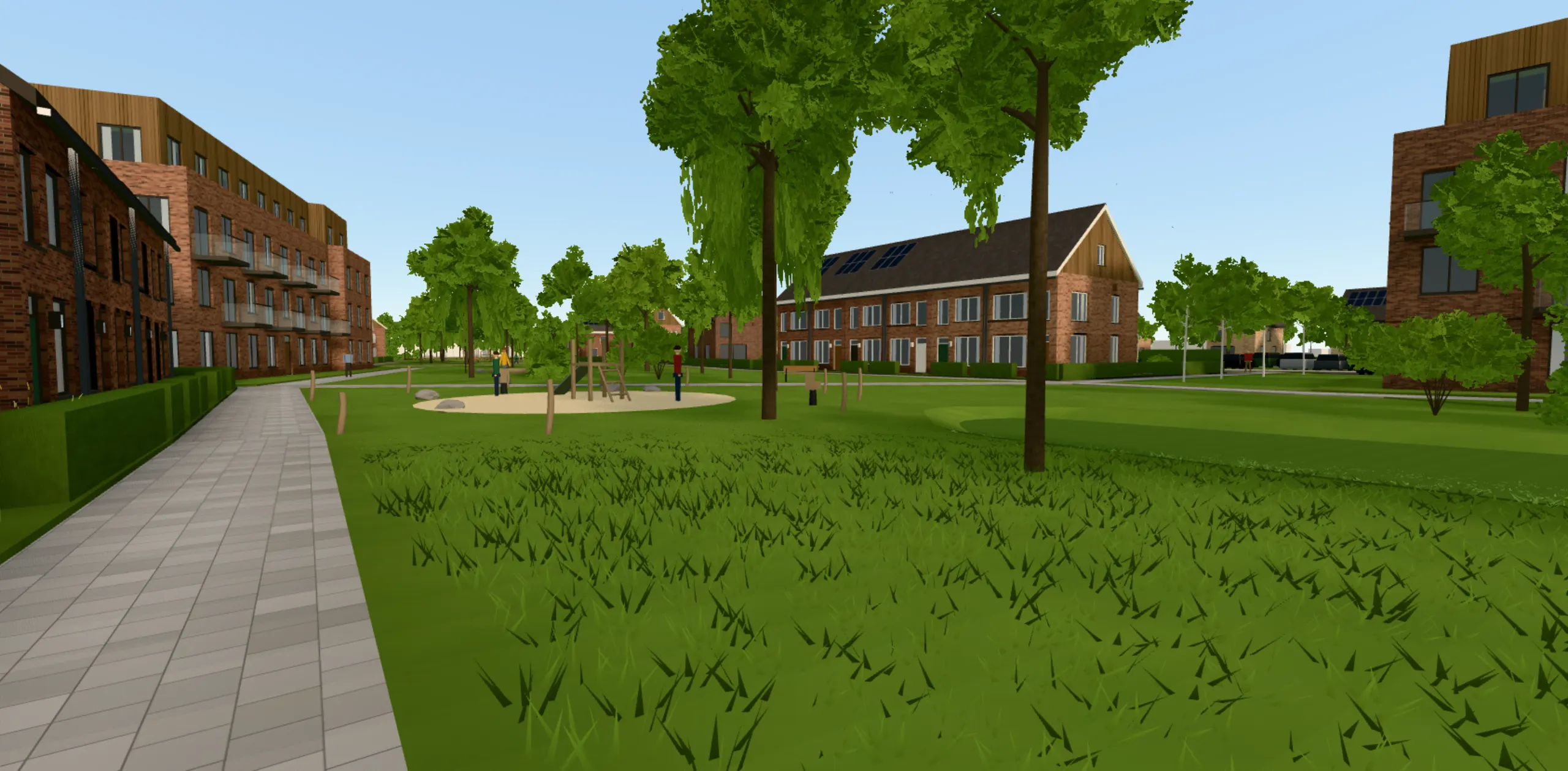
- Choose from the Bird’s-eye, Low, Park and Above views
- Walk through the streets themselves using the arrow keys or W A S D
- Follow a guided tour past the places in the neighbourhood
- Use the map to jump straight to eleven places, from the Lateraalpark to the green courtyards
The interactive environment only loads once you click here.
Places in the neighbourhood
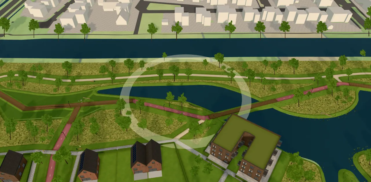 Het Lateraalpark
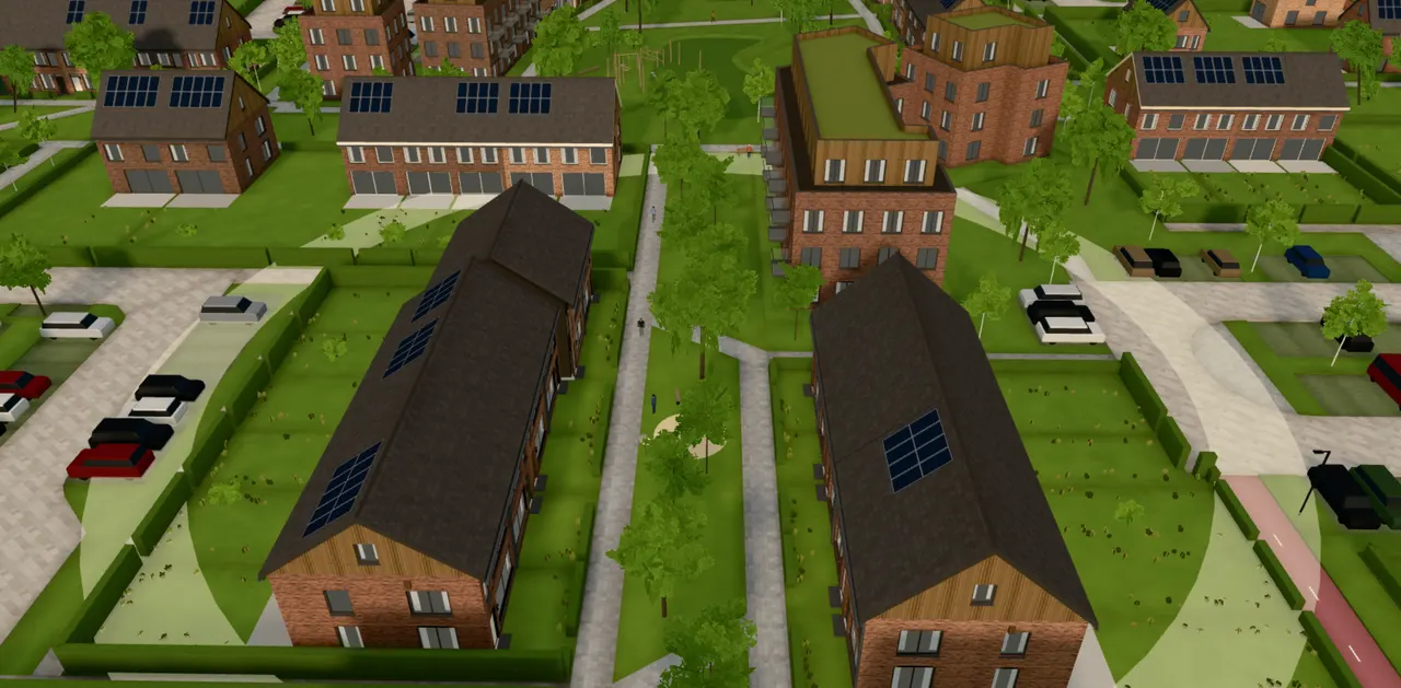 Groene hofjes
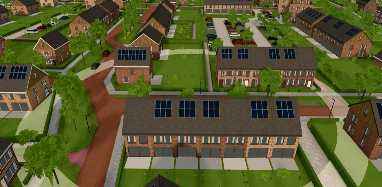 Dorpse straten
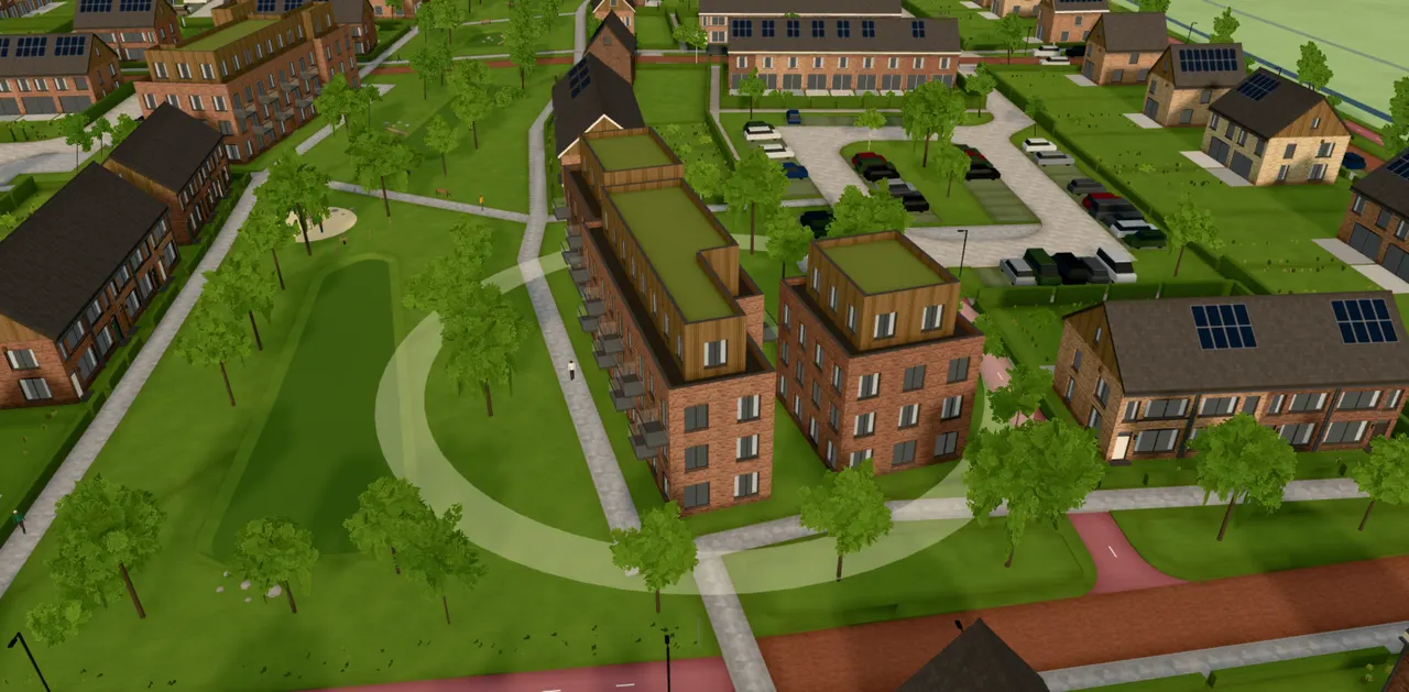 Appartementen aan het groene lint
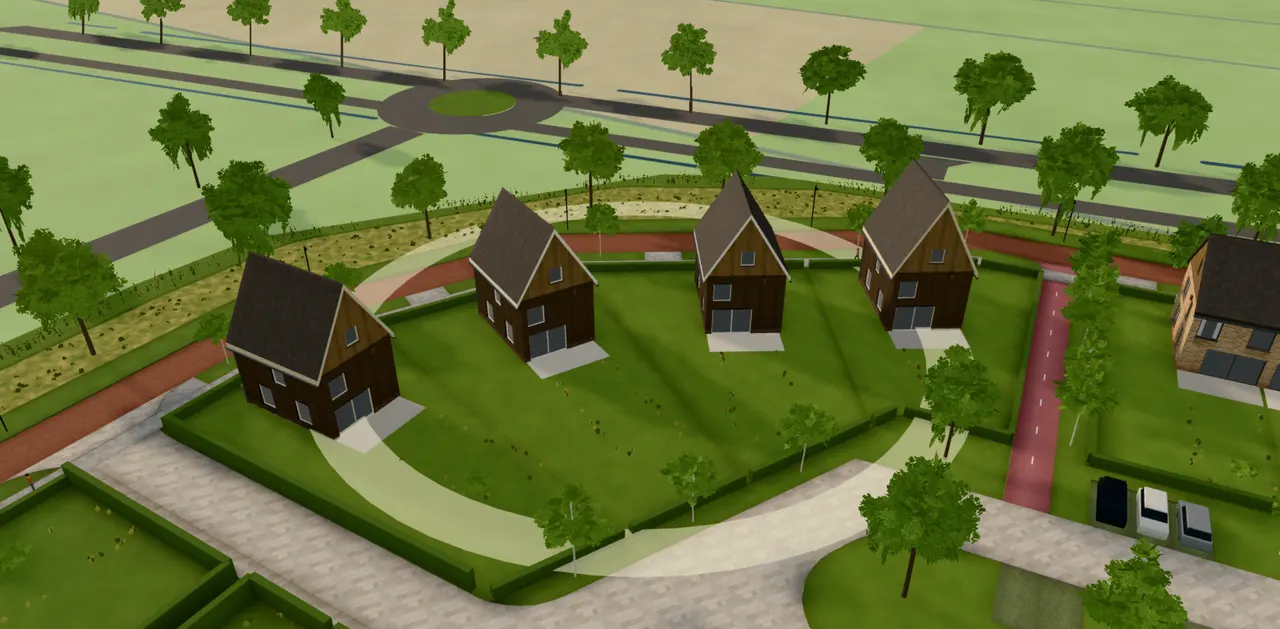 Bijzondere woningen
Impression. Surroundings: 3D Basisvoorziening, © Kadaster, CC BY 4.0.
WHO WE MAKE 3D FOR
Three audiences. One goal: showing what’s coming.
Property developers
Let buyers experience the future.
A 3D environment or a series of renders makes a project tangible long before ground is broken. For buyers, investors and your own sales team.
- Property presentations and project marketing
- Support for pre-sales
- Investor presentations
- A clear picture of future buildings and areas
- Possibilities made visible before construction is finished
Municipalities
Make spatial plans easy to understand.
Reading a zoning map is hard. In a 3D environment, residents and stakeholders see for themselves what is coming, as with Vjenne Zuid for the municipality of Twenterand.
- Area development
- Urban design visualisations
- Communication with residents
- Public participation processes
- Presenting future living environments clearly
Architects
Bring your design to life.
Show how materials, light and space come together. That way you present a design to clients the way it will actually feel.
- Presenting designs convincingly
- Materials, light and spatial proportions
- Client presentations
- Architectural visualisations
- Visual support for design decisions
OUR APPROACH
How we bring your project to life.
Introduction & project analysis
We discuss the goals, the target audience and the available project information.
Concept & visual direction
We decide on the desired look, the level of detail and the right form of presentation.
3D modelling & visualisation
We turn the available plans and designs into a visual 3D experience.
Feedback & refinement
We refine the result based on feedback and the agreed project scope.
Delivery & presentation
We deliver the visualisations, animations or interactive environment in the agreed format.
QUESTIONS
Frequently asked questions about 3D visualisation
What does a 3D visualisation cost?
That depends on what you need: a few renders, an animation or a complete interactive environment, and how much detail the project calls for. Tell us what you have in mind and we’ll put together a tailored quote.
Which files do you need to create a 3D model?
Anything that describes the design helps: drawings, site plans, existing 3D models or reference images. During the introduction we look together at what is already there and what is still needed.
Can you visualise an entire residential area in 3D?
Yes. Vjenne Zuid shows an entire future neighbourhood, with homes, streets, greenery and water. For the surroundings we used the 3D Basisvoorziening from the Kadaster.
Can visitors navigate a 3D environment themselves?
Yes. In Vjenne Zuid, visitors choose a view, walk through the streets themselves or follow a guided tour past the places in the neighbourhood. It simply works in the browser, with nothing to install.
What is the difference between a 3D render and an interactive 3D environment?
A render is a fixed image, like a photo: we choose the viewpoint, the light and the moment. In an interactive 3D environment, the visitor chooses the viewpoint and the route. Renders work well in brochures, on websites and on site hoardings; an interactive environment suits presentations, public participation and sales.
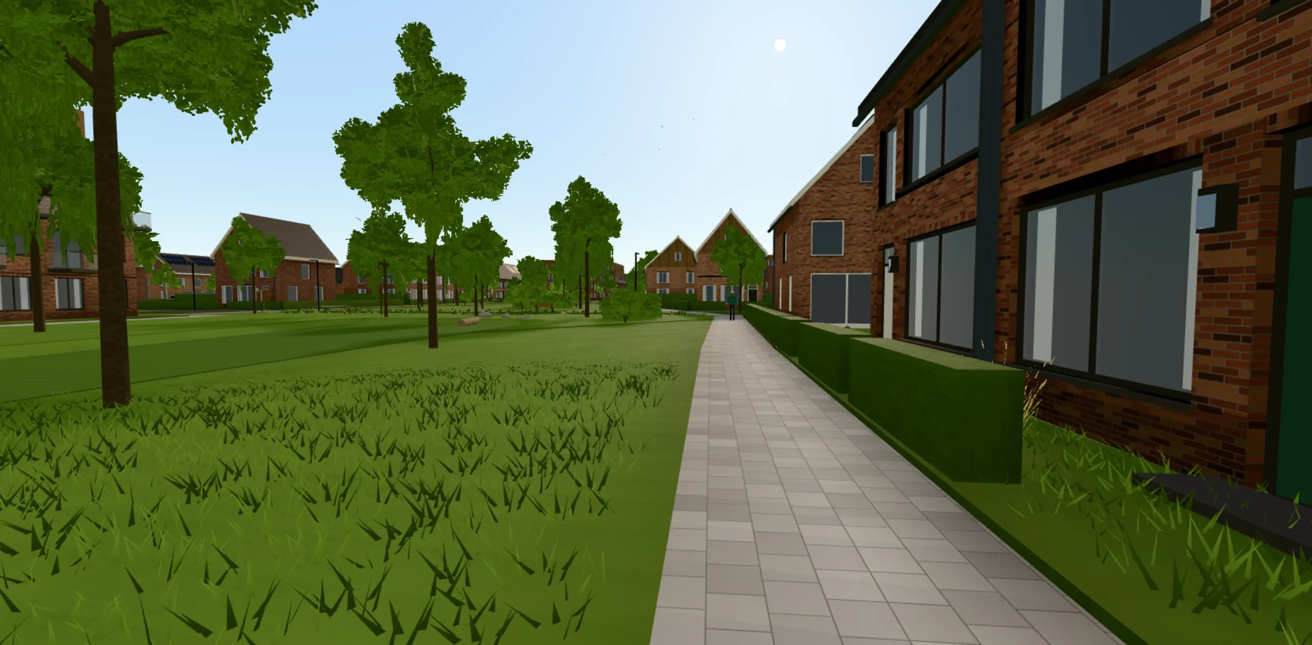
Experience tomorrow. Today.
Your next project starts here.
Want to present a new-build project, area development or architectural design convincingly? Tell us what you have in mind. We’ll help you explore what 3D can do.